Satellite Remote Sensing
MODIS
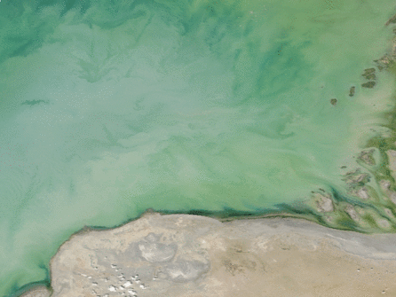
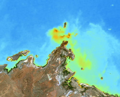
IMO has collected the full series of MODIS Terra and Aqua imagery over Australia since their respective launches (2000, 2002). These polar orbiting satellite images have bands sensitive to sediment load at 250m resolution. The MODIS data may be processed with region-specific algorithms to provide maps of sediment concentration in coastal regions. These images may be beneficial to clients looking to establishing natural sediment concentration ‘background’ levels and the spatial patterns of natural variability for their region of interest. During dredging, Near-Real-Time imagery may also be used to monitor plume extent and even help validate oceanographic sediment transport model outputs. IMO can provide quality controlled, cloud, glint and shallow water corrected or masked image products for a range of ocean colour satellite sensors (MODIS, VIIRS, Landsat, Worldview, etc.).
Remote Sensing Services
- Near-Real-Time Satellite Subscription
- MODIS, VIIRS, Sential, Landsat, Worldview,
- Satellite Water Quality Maps
- Historical Data Processing
- Region-specific Algorithm Development
- Baseline Assessment
- Seasonal Analysis
Contact Sales